Beyond the Waterfront: Darwin's Hidden Nature Walks Locals Love but Tourists Miss
While visitors queue for the wave lagoon and Mindil Beach sunsets, Darwin's regulars are logging kilometres on trails that don't appear in any hotel brochure.
While visitors queue for the wave lagoon and Mindil Beach sunsets, Darwin's regulars are logging kilometres on trails that don't appear in any hotel brochure.
Darwin has roughly 148 kilometres of walking and cycling trails stitched through its suburbs, coastal fringes and monsoon forest pockets — and the vast majority of them never see a tourist. That gap between what gets marketed and what locals actually use is widening, and for anyone who moved here in the past two years, navigating it can take months of word-of-mouth.
The timing matters. July is the sweet spot: overnight lows sitting around 20 degrees, humidity below 60 percent, and the dry-season light that turns the sandstone escarpment copper by six in the morning. Darwin's outdoor fitness culture is at its annual peak right now, and the trails filling up before sunrise are not the ones on the Tourism NT map.
Charles Darwin National Park, tucked behind the East Arm industrial corridor off Tiger Brennan Drive, is the most underrated 1,700 hectares in the Northern Territory. The park's coastal trail runs along mangrove-lined tidal flats where saltwater crocodile warning signs are plentiful but foot traffic is thin. Darwin Runners Club uses the dirt tracks around the park's perimeter for Wednesday morning sessions, and members have been doing so for years without much fanfare from the wider fitness industry. Entry is free, the carpark off Tinamar Drive fits about thirty cars, and by 7 a.m. on a weekday you'll share the place with maybe a dozen people.
Casuarina Coastal Reserve is better known but still largely a local secret. The 1.5-kilometre stretch of beach north of Lee Point Road is backed by she-oak forest dense enough to cut the wind and provide genuine shade. The walking trail along the foreshore connects through to Buffalo Creek, where the mangrove boardwalk — roughly 400 metres, built in stages from 2019 — puts you directly above water that fills with egrets and kingfishers at low tide. Buffalo Creek Road dead-ends at a small boat ramp carpark that functions as a de facto trailhead. No signage advertising it. No coffee cart. That's the point.
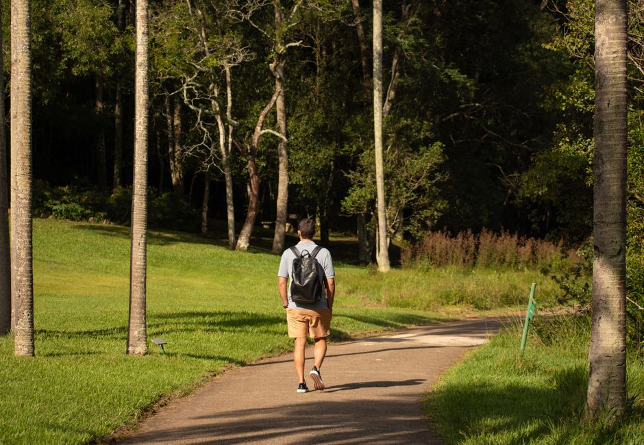
Further south, Ludmilla Creek Linear Park threads through the suburb of Fannie Bay along a flat, sealed path that the City of Darwin has quietly upgraded over the past three years. The path runs for just over two kilometres between Dick Ward Drive and the Fannie Bay Gaol precinct, passing restored monsoon vine thicket that the city's urban greening program has been replanting since 2023. It is genuinely beautiful in the dry season and almost entirely ignored by anyone who doesn't live within walking distance of it.
Top End Health Service data published in late 2025 flagged physical inactivity as a contributing factor in approximately 38 percent of preventable chronic disease presentations at Royal Darwin Hospital — a figure that local GPs have cited when pushing for better public awareness of existing green infrastructure. The infrastructure exists. The promotion doesn't.
Darwin's population sits at roughly 148,000 people across Greater Darwin, and the City of Darwin's own surveys suggest around 60 percent of residents nominate outdoor walking as their primary form of exercise. The disconnect between that participation rate and the city's trail marketing budget — which skews heavily toward the Waterfront precinct and the Esplanade — is a long-standing frustration among local fitness groups.
For anyone looking to start: the Darwin Bushwalkers club holds a free orientation walk on the first Saturday of each month, meeting at 7 a.m. at the Casuarina shopping centre carpark. The group's trail notes, distributed by email, include GPS coordinates for trailheads that don't appear on Google Maps. Bring two litres of water even in July, wear closed shoes on anything off the sealed path, and check the Northern Land Council's seasonal access notices before heading to any track north of Lee Point — some areas restrict access depending on traditional owner arrangements and prescribed burning schedules. For anything involving a health condition or injury, check with a Darwin-based GP or physiotherapist before you lace up.
Your reaction
Spread the word
About this article
Published by The Daily Darwin
Daily brief
Free, in your inbox before 7am. Weekdays.
The Daily Network — local news across Australia